 -08


Aug. 12, 2007
Tsuruoka -- Mt. Gassan 8th Station ······> Mt. Gassan 9th Station
(40.16 km)
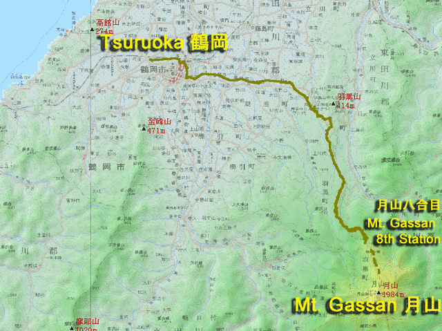

Tsuruoka
 |
|
 |
|
Mt. Gassan 8th Station
  |
|
Mt. Gassan 9th Station
|
|
||||
| Weather |  fine |
|
|---|---|---|
| Route (prefecture) |
Tsuruoka (Yamataga) -- (Pref. Road 47, 211) -- Mt. Gassan 8th Station (Yamagata) ······ (walking) ······ Mt. Gassan 9th Station (Yamagata) |
|
| detail track (by Google Maps) (Click!) | ||
|
||
| Distance | 40.16 km | |
| Time | 4 hour 06 minutes 15 seconds | |
| Average speed | 9.7 km/h | |
| Max. speed | 35.4 km/h | |
| Difference of altitude | 1545 m (+???m, including walking) | |
| Profile Maps (Click!) | ||
| Note | The hill climb to 8th Station of Mt. Gassan is too hot in spite of it is northern part of Japan. | |
| Accommodation [charge] |
Busshoike-goya (mountain hut) [??? yen] |
|
| Diary | |
